|
Rural Municipality of Canwood No. 494
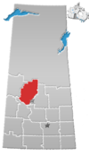
The Rural Municipality of Canwood No. 494 (2021 population: 1,351) is a rural municipality (RM) in the Canadian province of Saskatchewan within Census Division No. 16 and SARM Division No. 5. The RM is located in the north-central portion of the province, west of the city of Prince Albert. HistoryThe RM of Thompson No. 494 was originally incorporated as a rural municipality on January 1, 1913.[2] Its name was changed to the RM of Canwood No. 494 on April 29, 1916.[3] GeographyThe RM is bordered to the north by the RM of Big River No. 555, to the northeast by Prince Albert National Park, to the west by the RM of Spiritwood No. 496, to the south by the RM of Leask No. 464, and to the east by the RM of Shellbrook No. 493.[6] Communities and localitiesThe following urban municipalities are surrounded by the RM. The following unincorporated communities are within the RM.
The RM completely and partially surrounds the Indian reserves of Ahtahkakoop 104 and Mistawasis 103 respectively.[6] Canwood Regional ParkCanwood Regional Park (53°21′53″N 106°32′45″W / 53.3647°N 106.5457°W) is set in a forest of jack pines and is located about 5 kilometres (3.1 mi) east of the village of Canwood. Initial development of the park began in 1959 and, in 1961, it became a regional park. The park has a golf course, a campground, picnic area, ball diamonds, and hiking trails.[7][8] The campground has 20 electrified campsites, potable water, and a washroom and shower facility. The campground is central to the other amenities of the park.[9] Canwood Regional Park Golf Club is a 9-hole, grass greens golf course with a clubhouse, which is open daily for concession and meals, a pro shop, and two tees per hole. It is a par 35 course with white tees totalling 2,885 yards and red tees totalling 2,625.[10] DemographicsIn the 2021 Census of Population conducted by Statistics Canada, the RM of Canwood No. 494 had a population of 1,351 living in 576 of its 808 total private dwellings, a change of -2.2% from its 2016 population of 1,381. With a land area of 1,919.39 km2 (741.08 sq mi), it had a population density of 0.7/km2 (1.8/sq mi) in 2021.[5] In the 2016 Census of Population, the RM of Canwood No. 494 recorded a population of 1,381 living in 565 of its 777 total private dwellings, a -3% change from its 2011 population of 1,424. With a land area of 1,945.2 km2 (751.0 sq mi), it had a population density of 0.7/km2 (1.8/sq mi) in 2016.[13] Transportation
The Canwood RM area is currently serviced by the Carlton Trail Railway, a shortline of the Canadian National Railway.
GovernmentThe RM of Canwood No. 494 is governed by an elected municipal council and an appointed administrator that meets on the third Tuesday of every month.[4] The reeve of the RM is Lyndon Pease while its administrator is Lorna Benson.[4] The RM's office is located in Canwood.[4] See alsoReferences
|
||||||||||||||||||||||||||||||||||||||||||||||||

