|
Sareni, Uttar Pradesh
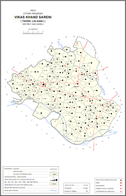
Sareni is a village and corresponding community development block in Lalganj tehsil of Rae Bareli district, Uttar Pradesh, India.[2] Historically the seat of a pargana,[3] it is located 18 km from Lalganj, the tehsil headquarters,[4] on the road to Daundia Khera in Unnao district.[3] As of 2011, Sareni has a population of 4,819 people, in 792 households.[2] It has 3 primary schools and no healthcare facilities Subedar major Babu Singh native of Bahadurpur making keen effort in development of local society like cleaners schools Prathmik Swasthya Kendra .[2] It serves as the headquarters of a nyaya panchayat which also includes 10 other villages.[5] HistorySareni was supposedly first founded by a member of the Bais clan named Sarang Sah.[3] It was first made headquarters of a pargana and tehsil during the reign of Saadat Ali Khan (which one is not specified in the source).[3] Previously, the pargana had been part of four different mahals: Kahanjara, Nisgar, Deorakh, and Tara Singhaur.[3] At the turn of the 20th century, Sareni had a police station, a post office, a cattle pound, and a large primary school.[3] It was held in taluqdari tenure by the Rana of Khajurgaon, as part of the Murarmau estate.[3] The population in 1901 was 1,458, including a Muslim minority of 202.[3] The 1951 census recorded Sareni as comprising 7 hamlets, with a total population of 1,466 people (779 male and 687 female), in 281 households and 149 245 houses.[6] The area of the village was given as 1,197 acres.[6] 153 residents were literate, 147 male and 6 female.[6] The village was listed as belonging to the pargana of Sareni and the thana of Sareni.[6] The 1961 census recorded Sareni as comprising 5 hamlets, with a total population of 1,883 people (955 male and 928 female), in 334 households and 290 physical houses.[7] The area of the village was given as 1,197 acres and it had a medical practitioner and post office at that point.[7] It also had the following small industrial establishments: 1 grain mill, 1 maker of clothing, 2 makers of wooden products not further classified, and 1 maker of jewellery or precious metal items.[7] The village's police staff consisted of 2 sub-inspectors, 1 head constable, and 14 constables.[7] The 1981 census recorded Sareni as having a population of 2,575 people, in 414 households, and having an area of 457.70 hectares.[4] The main staple foods were given as wheat and rice.[4] The 1991 census recorded Sareni as having a total population of 3,419 people (1,777 male and 1,642 female), in 583 households and 583 physical houses.[5] The area of the village was listed as 458 hectares.[5] Members of the 0-6 age group numbered 707, or 21% of the total; this group was 56% male (396) and 44% female (311).[5] Members of scheduled castes made up 19% of the village's population, while no members of scheduled tribes were recorded.[5] The literacy rate of the village was 40% (950 men and 406 women).[5] 919 people were classified as main workers (786 men and 133 women), while 2 people were classified as marginal workers (both women); the remaining 2,498 residents were non-workers.[5] The breakdown of main workers by employment category was as follows: 280 cultivators (i.e. people who owned or leased their own land); 253 agricultural labourers (i.e. people who worked someone else's land in return for payment); 2 workers in livestock, forestry, fishing, hunting, plantations, orchards, etc.; 0 in mining and quarrying; 38 household industry workers; 66 workers employed in other manufacturing, processing, service, and repair roles; 4 construction workers; 133 employed in trade and commerce; 9 employed in transport, storage, and communications; and 134 in other services.[5] VillagesSareni CD block has the following 160 villages:[2]
References
|
|||||||||||||||||||||||||||||||||||||||||||||||||||||||||||||||||||||||||||||||||||||||||||||||||||||||||||||||||||||||||||||||||||||||||||||||||||||||||||||||||||||||||||||||||||||||||||||||||||||||||||||||||||||||||||||||||||||||||||||||||||||||||||||||||||||||||||||||||||||||||||||||||||||||||||||||||||||||||||||||||||||||||||||||||||||||||||||||||||||||||||||||||||||||||||||||||||||||||||||||||||||||||||||||||||||||||||||||||||||||||||||||||||||||||||||||||||||||||||||||||||||||||||||||||||||||||||||||||||||

