Share to:


ギルナール山

ギルナール山
標高 1031 m
位置 北緯21度29分41秒 東経70度30分20秒 / 北緯21.49472度 東経70.50556度 / 21.49472; 70.50556座標: 北緯21度29分41秒 東経70度30分20秒 / 北緯21.49472度 東経70.50556度 / 21.49472; 70.50556
種類 火成岩
ギルナール山の位置(インド内)
ギルナール山
ギルナール山 (インド)
プロジェクト 山
テンプレートを表示

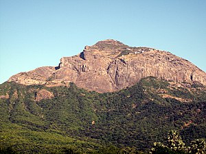
ギルナール山(ギルナールさん、ヒンディー語: गिरनार, グジャラート語: ગિરનાર, Girnār)は、インドグジャラート州ジュナーガド県に位置する山。最高峰は標高1031メートルで、グジャラート州では最も高い[1]ヒンドゥー教ジャイナ教の聖地になっている。

文化

ギルナール山は県都ジュナーガドの東に位置する。「ギルナール」という名前はサンスクリット「giri-nagara」(山の町)に由来する[2]

グジャラート一帯にはインダス文明のころから文明が栄えた。ギルナールには紀元前3000年に作られた貯水池がある[3]

ギルナールには有名なアショーカ王の磨崖碑文がある。同じ岩に西クシャトラパルドラダーマン(2世紀)およびグプタ朝のスカンダグプタ(5世紀)の碑文も刻まれている[4]

ジャイナ教では22番目のティールタンカラであるネーミナータがギルナール山で入滅したとされ[5]、山中には白衣派の多数の寺院がある[6]

巡礼のために峰をめぐる石づくりの道が造られている。最高峰の寺院まで9999段の石段があると言われているが、実際には8000段ほどである[1]

脚注

  1. ^ a b Junagadh, Discover India, https://discoverindiabyroad.blogspot.in/p/history-of-junagadh-girnar.html 
  2. ^ Macdonell (1900) p.15
  3. ^ Shadanam Nair (2004) p.161
  4. ^ Salomon (1998) pp.136-137,89,145
  5. ^ Jacobi (1884) pp.276-279
  6. ^ 渡辺(2005) p.296

参考文献

  • Jacobi, Hermann (1884). Gaina Sûtras: Part I. The Sacred Books of the East. XXII. Oxford: Clarendon Press. https://archive.org/stream/1922707.0022.001.umich.edu#page/276/mode/2up 
  • Macdonell, Arthur A. (1900). A History of Sanskrit Literature. New York: D. Appleton and Company. https://archive.org/details/historyofsanskri00macduoft 
  • K. Shadanam Nair. “Role of water in development of civilization in India--a review of ancient literature, traditional practices and beliefs”. In John C. Rodda; Lucio Ubertini. The Basis of Civilization--Water Science?. IAHS Press. pp. 160-166. ISBN 1901502570 
  • Salomon, Richard (1998). Indian Epygraphy: A Guide to the Study of Inscriptions in Sanskrit, Prakrit, and the Other Indo-Aryan Languages. Oxford University Press. ISBN 0195099842 
  • 渡辺研二『ジャイナ教』論創社、2005年。ISBN 4846003132 
Kembali kehalaman sebelumnya