Flein
| Wappa | Deitschlandkart | |
|---|---|---|

|
| |
| Basisdata | ||
| Bundesland: | Bade-Wirttebärg | |
| Regierongsbezirk: | Stuegert | |
| Landkroes: | Haalbrunn | |
| Heh: | 212 m i. NHN | |
| Fläch: | 8,47 km² | |
| Eiwohner: |
7432 (31. Dez. 2024)[1] | |
| Bevelkerongsdicht: | 877 Eiwohner je km² | |
| Boschtloetzahl: | 74223 | |
| Vorwahl: | 07131 | |
| Kfz-Kennzoeche: | HN | |
| Gmoedsschlissel: | 08 1 25 030 | |
| Adress vo dr Gmoedsverwaltong: |
Kellergasse 1 74223 Flein | |
| Webpräsenz: | ||
| Schuldes: | Alexander Krüger | |
| Lag vo de Gmoed Flein em Landkroes Haalbrunn | ||
 | ||

Flei (amtlich Flein ()) ischt a Gmoed em Landkroes Haalbrunn en Bade-Wirttebärg. D Gmoed hot 7432 Eiwohner (Stand: 31. Dezember 2024).
Geografi
Flei leit am Deinenbach, mo em Nochberort Sontheim en d Schozach mendet. D Nochbergmoede vo Flei send Heilbronn, Untergruppenbach ond Talheim.
Vo dr Gmarkong send 60 % Landwirtschaftsfleche, 13 % Wald, 26,2 % Sidlongsfleche ond 0,8 % sonschtiche Fleche.[2]
Gmoedsglidrong
Zua Flei gheret koene weitere Ortsdoel.
Gschicht
Flei ischt zom erschte Mol gnennt worda em Johr 1188 als Flina.
Verwaltong
Flei hot sich mit Talheim zom a Gmoeverwaltongsverband zammagschlossa.
Dr Schuldes vo Flei ischt dr Alexander Krüger.
Wahla
Ergäbnis vo de Landdagswahla seid 2006:[3]
| Johr | CDU | Greane | SPD | FDP | Lenke1 | AfD | Sonschtiche |
| 2016 | 27,4 % | 27,7 % | 14,2 % | 13,5 % | 1,7 % | 12,7 % | 2,7 % |
| 2011 | 41,5 % | 20,5 % | 24,6 % | 7,7 % | 1,9 % | 3,8 % | |
| 2006 | 44,3 % | 8,4 % | 26,4 % | 15,7 % | 1,7 % | 3,5 % |
1 2006: WASG, seid 2011: Die Linke
Dialekt
Dr Dialekt vo Flei ghert zom Sidfränkisch.
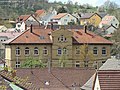
Bilder
-
 s Alt Rothaus
 -
 s Nui Rothaus
 -
 Schualhaus
 -
 Fischerhaus
 -
 Dreifaltigkeitskirch
 -
 Ev. Kirch St. Veit
 -
 Kornhaus


Literatur
- Peter Wanner (Hrsg.): Flein, Flein, du edler Fleck. Gemeinde Flein, Flein 1988.
Weblink
 Commons: Flein – Sammlig vo Multimediadateie
 Flein in der Beschreibung des Oberamts Heilbronn von 1865 im dütschsprochige Wikisource
- www.flein.de
Fuaßnota
- ↑ Statistisches Landesamt Baden-Württemberg – Tabellengruppe 12411: Fortschreibung des Bevölkerungsstandes zum 31. Dezember 2024 (Hilfe dazu).
- ↑ Statistisches Bundesamt: Bodenfläche nach Art der tatsächlichen Nutzung - Stichtag 31.12. - regionale Tiefe: Gemeinden, Samt-/Verbandsgemeinden (bis 2011)
- ↑ Statistisches Landesamt Baden-Württemberg: Landtagswahl (Memento vom 7. Juli 2019 im Internet Archive)
Content Disclaimer
Informasi ini disarikan dari Wikipedia dan disajikan kembali untuk tujuan edukasi. Konten tersedia di bawah lisensi CC BY-SA 3.0. Kami tidak bertanggung jawab atas ketidakakuratan data yang bersumber dari kontribusi publik tersebut.
- The information displayed on this website is sourced in part or in whole from Wikipedia and has been adapted for the purpose of restating it. We strive to provide accurate and relevant information, however:
- There is no guarantee of absolute accuracy. Wikipedia is an open, collaborative project that can be edited by anyone, so information is subject to change.
- It is not intended to constitute professional advice. The content displayed is for informational and educational purposes only. For important decisions (e.g., medical, legal, or financial), please consult a professional.
- Content copyright. Wikipedia is licensed under the Creative Commons Attribution-ShareAlike License (CC BY-SA). This means that content may be reused with appropriate attribution and shared under a similar license.
- Responsible use. Any risk arising from the use of information from this website is entirely the responsibility of the user.


