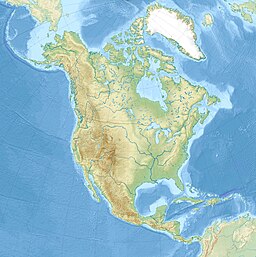
ทะเลสาบมิชิแกน ที่ตั้ง สหรัฐอเมริกา กลุ่ม เกรตเลกส์ พิกัด 44°N 87°W / 44°N 87°W / 44; -87 ชนิดของทะเลสาบ ธารน้ำแข็ง ชื่อในภาษาแม่ Ininwewi-gichigami (โอจิบเว ) แหล่งน้ำไหลเข้าหลัก ช่องแคบแมคคินอว์ , แม่น้ำฟ็อกซ์ , แม่น้ำแกรนด์ , แม่น้ำเมโนมินี , แม่น้ำมิลวอกี
, แม่น้ำมัสคีกอนr , แม่น้ำคาลามาซู , แม่น้ำเซนต์โจเซฟ แหล่งน้ำไหลออก ช่องแคบแมคคินอว์ ; และควบคุมการปล่อยน้ำผ่านประตู แม่น้ำชิคาโก (ช่องแคบฝั่งเหนือ ), และแม่น้ำคาลูเม็ต ประเทศในลุ่มน้ำ สหรัฐอเมริกา ช่วงยาวที่สุด 307 mi (494 km) ช่วงกว้างที่สุด 118 mi (190 km) ช่วงสั้นที่สุด 91 mi (146 km) พื้นที่พื้นน้ำ 22,404 sq mi (58,030 km2 )[ 5] ความลึกโดยเฉลี่ย 279 ft (85 m) ความลึกสูงสุด 923 ft (281 m)[ 6] ปริมาณน้ำ 1,183 cu mi (4,930 km3 ) เวลาพักน้ำ 99 ปี ความยาวชายฝั่ง1 1,400 mi (2,300 km) plus 238 mi (383 km) for islands[ 7] ความสูงของพื้นที่ 577 ft (176 m)[ 6] อ้างอิง [ 6] 1 ความยาวแนวชายฝั่งไม่ได้ถูกวัดอย่างละเอียด
ทะเลสาบมิชิแกน (อังกฤษ : Lake Michigan ) เป็นทะเลสาบ หนึ่งในหมู่ทะเลสาบทั้งห้า (เกรตเลกส์ ) ในทวีปอเมริกาเหนือ เป็นทะเลสาบเดียวที่อยู่ในเขตแดนของสหรัฐอเมริกา รัฐสำคัญโดยรอบได้แก่ รัฐวิสคอนซิน รัฐอิลลินอย รัฐอินดีแอนา และรัฐมิชิแกน มีขนาดใกล้เคียงกับประเทศโครเอเชีย โดยมีพื้นที่ประมาณ 58,000 ตารางกิโลเมตร ส่วนที่ลึกที่สุด 281 เมตร ความยาวชายฝั่ง 2,636 กิโลเมตร[ 8]
คำว่า "มิชิแกน" มาจากคำว่า "มิชิกามิ" ในภาษาโอจิบเว (mishigami [ 9]
↑ National Geophysical Data Center เก็บถาวร เมษายน 3, 2015 ที่ เวย์แบ็กแมชชีน , 1996. Bathymetry of Lake Michigan. National Geophysical Data Center, NOAA. doi:10.7289/V5B85627 [access date: March 23, 2015].↑ National Geophysical Data Center เก็บถาวร เมษายน 3, 2015 ที่ เวย์แบ็กแมชชีน , 1999. Bathymetry of Lake Huron. National Geophysical Data Center, NOAA. doi:10.7289/V5G15XS5 [access date: March 23, 2015]. (only small portion of this map)↑ National Geophysical Data Center, 1999. Global Land One-kilometer Base Elevation (GLOBE) v.1. เก็บถาวร กุมภาพันธ์ 10, 2011 ที่ เวย์แบ็กแมชชีน Hastings, D. and P.K. Dunbar. National Geophysical Data Center, NOAA. doi:10.7289/V52R3PMS [access date: March 16, 2015].
↑ "About Our Great Lakes: Tour" . National Oceanic and Atmospheric Administration (NOAA), Great Lakes Environmental Research Laboratory (GLERL). คลังข้อมูลเก่าเก็บจากแหล่งเดิม เมื่อ May 7, 2017. สืบค้นเมื่อ December 15, 2017 .↑ "Lake Michigan" . Great-lakes.net. June 18, 2009. คลังข้อมูลเก่าเก็บจากแหล่งเดิม เมื่อ January 1, 2010. สืบค้นเมื่อ January 14, 2010 .↑ 6.0 6.1 6.2 Wright 2006 , p. 64 harvnb error: multiple targets (2×): CITEREFWright2006 (help ) ↑ Shorelines of the Great Lakes เก็บถาวร เมษายน 5, 2015 ที่ เวย์แบ็กแมชชีน ↑ Wright, John W., บ.ก. (2006). The New York Times Almanac (2007 ed.). New York, New York: Penguin Books. p. 64. ISBN 0-14-303820-6 ↑ "Superior Watershed Partnership Projects" . คลังข้อมูลเก่าเก็บจากแหล่งเดิม เมื่อ 28 กันยายน 2007. สืบค้นเมื่อ 8 พฤศจิกายน 2008 .
Bogue, Margaret Beattie (1985). Around the Shores of Lake Michigan: A Guide to Historic Sites University of Wisconsin Press . ISBN 0-299-10004-9 Hilton, George Woodman (2002). Lake Michigan Passenger Steamers . Stanford University Press. ISBN 0-8047-4240-5 Hyde, Charles K.; Mahan, Ann; Mahan, John (1995). The Northern Lights: Lighthouses of the Upper Great Lakes . Detroit : Wayne State University Press . ISBN 978-0-814325-54-4 Oleszewski, Wes (1998). Great Lakes Lighthouses, American and Canadian: A Comprehensive Directory/Guide to Great Lakes Lighthouses Gwinn : Avery Color Studios, Inc. ISBN 0-932212-98-0 Penrod, John (1998). Lighthouses of Michigan . Berrien Center : Pernod/Hiawatha. ISBN 978-0-942618-78-5 Penrose, Laurie; Penrose, Bill (1999). A Traveler's Guide to 116 Michigan Lighthouses Petoskey : Friede Publications. ISBN 978-0-923756-03-1 Shelak, Benjamin J. (2003). Shipwrecks of Lake Michigan ISBN 1-931599-21-1 Wagner, John L. (1998). Michigan Lighthouses: An Aerial Photographic Perspective . East Lansing : John L. Wagner. ISBN 978-1-880311-01-1 Wright, John W., บ.ก. (2006). The New York Times Almanac The New York Times (2007 ed.). New York, New York: Penguin Books. ISBN 0-14-303820-6 Wright, Larry; Wright, Patricia (2006). Great Lakes Lighthouses Encyclopedia ISBN 1-55046-399-3
ทะเลสาบหลัก ทะเลสาบรอง อ่าวและ
อิรี ฮูรอน มิชิแกน ออนแทรีโอ สุพีเรีย เซนต์แคลร์
ทางน้ำ เกาะ ธรณีประวัติ องค์กร หัวข้อที่เกี่ยวข้อง


